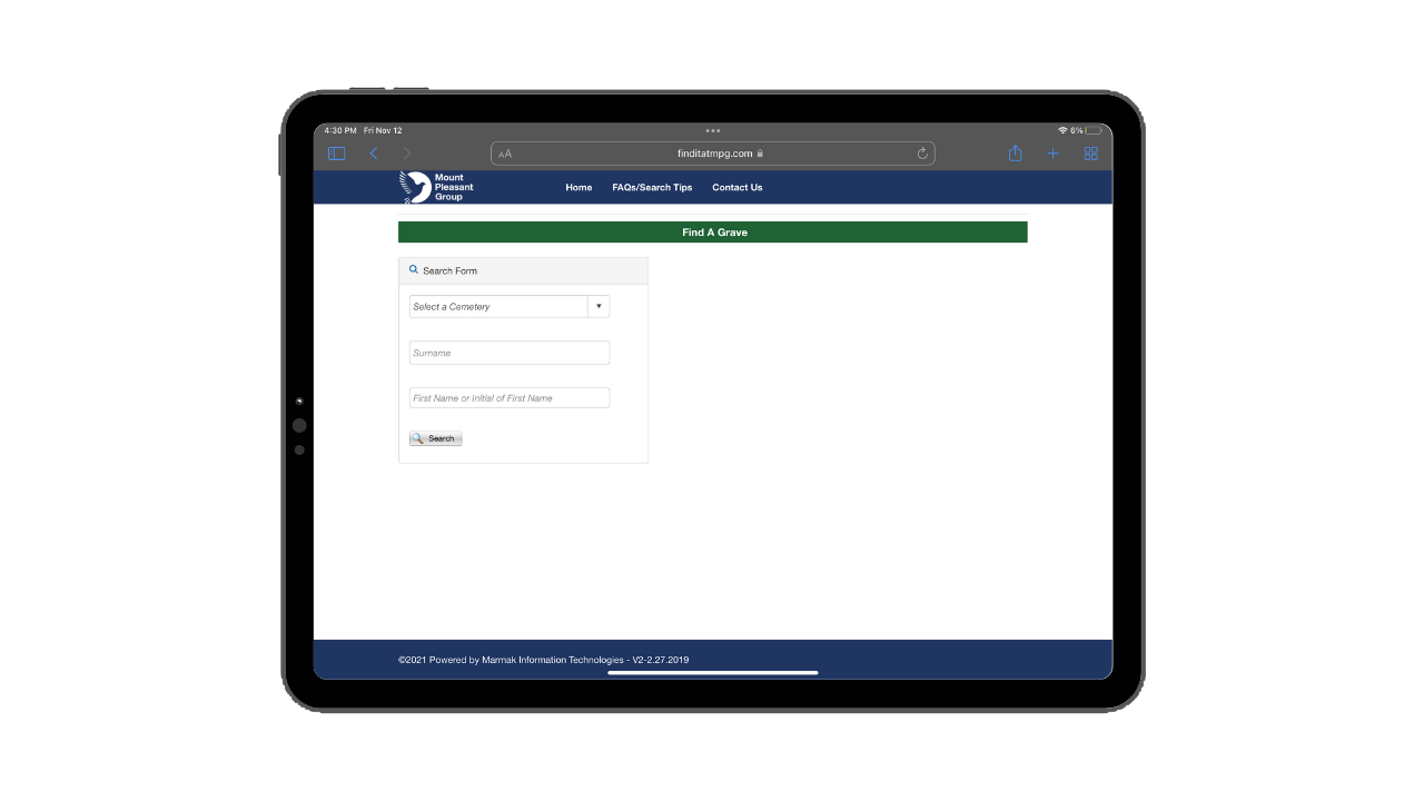
Cemetery Management

Improve the Management of Cemeteries.
Enhances the dissemination of accurate and up to date cemetery data.
Looking to electronically collect and manage plot data?
Looking to make historical cemetery information available to the general public?
Reduce mistakes and free up staff time?

Benefits of using FGS:
Easy Access
User Friendly
Visualize Information
Modules
-
![]()
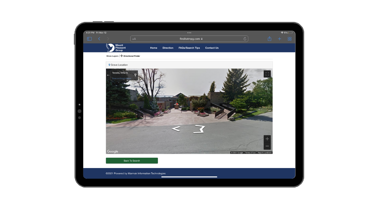
Spotlight
Access burial location.
-
![]()
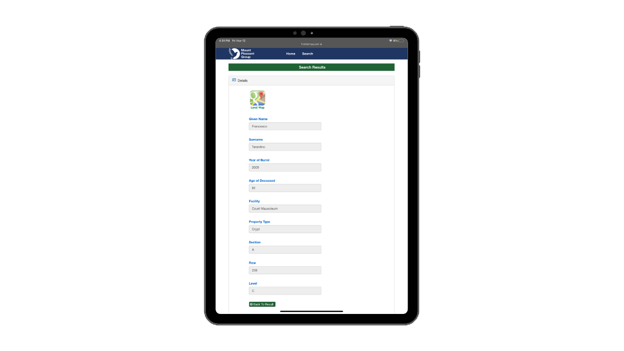
Inventory
Review crypt details.
-
![]()
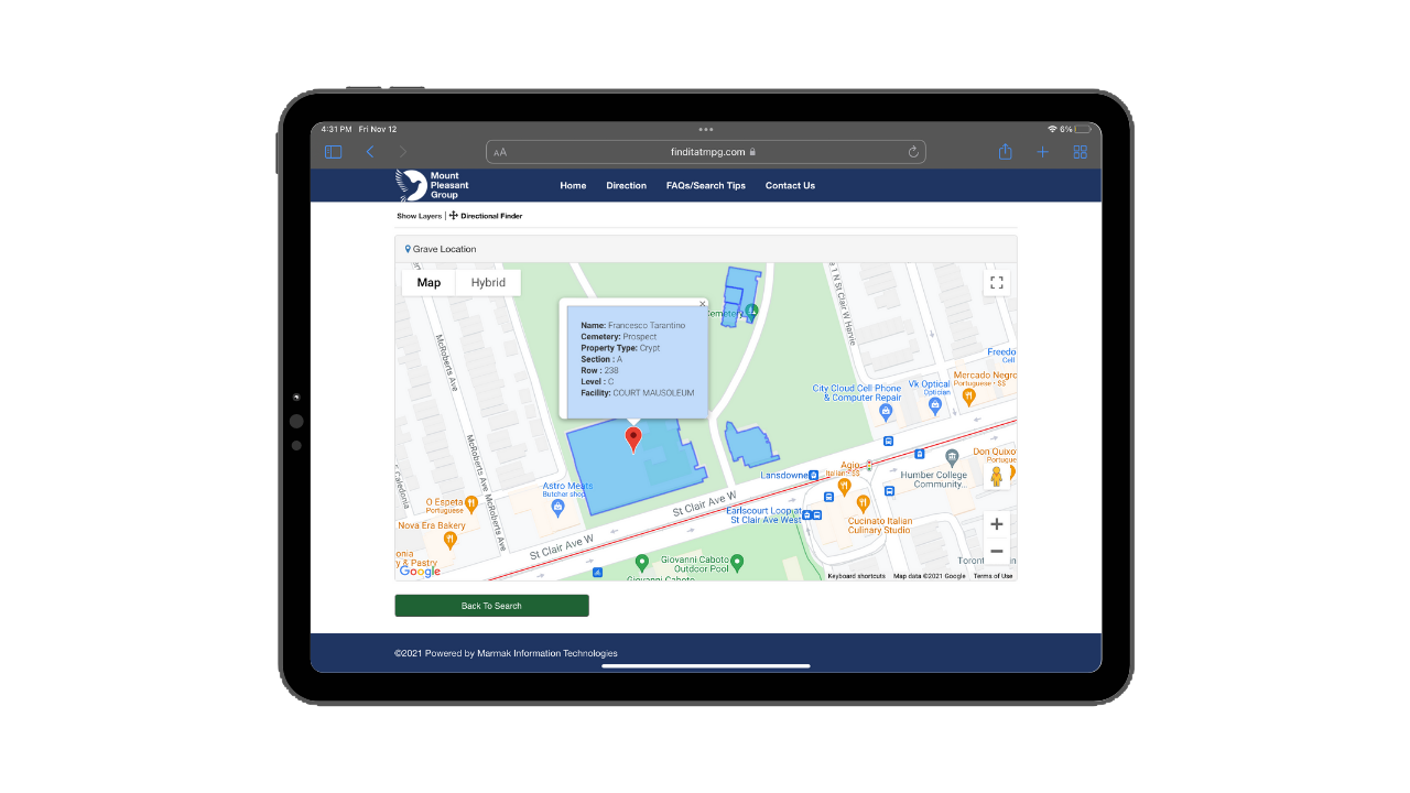
Details
Find point location.
-
![]()
Visualization
Pinpoint location.